Land Library Search
Through our robust search engine, you can search for any item of the over 73,000 highly curated resources in the Land Library.
If you would like to find an overview of what is possible, feel free to peruse the Search Guide.
/ library resources
Showing items 1 through 9 of 47.Since 2009, the Government of Switzerland and RECOFTC have partnered with ASEAN through the Swiss Agency for Development and Cooperation (SDC)’s support to the ASEAN Social Forestry Network (ASFN) and the ASEAN-Swiss Partnership on Social Forestry and Climate Change (ASFCC).
Zero-deforestation commitments are emerging rapidly in Indonesia.
For cities to be sustainable, they need to simultaneously address the vulnerability of people, places and sectors that may be affected by a changing climate; mitigate their greenhouse gas (GHG) emissions; and ensure adequate access to basic urban services such as water, food and energy to their g
This document lays down the Zambia National Strategy to Reduce Emissions from Deforestation and Forest Degradation (REDD+). Zambia has developed this strategic document under the REDD+ mechanism.
The paper reviews research showing that soils contain more carbon than atmosphere and all plant life combined, noting that increasing carbon storage in soils is relatively simple compared to approaches to use geoengineering to avert climate change.
The agriculture, forestry and other land use (AFOLU) sector is responsible for approximately 25% of anthropogenic GHG emissions mainly from deforestation and agricultural emissions from livestock, soil and nutrient management.
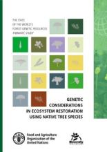
There is renewed interest in the use of native tree species in ecosystem restoration for their biodiversity benefits. Growing native tree species in production systems (e.g. plantation forests and subsistence agriculture) can also ensure landscape functionality and support for human livelihoods.
Europa is de laatste honderd jaar enorm verstedelijkt, maar óók groener geworden. Sinds 1900 nam het bosareaal met een derde toe; landbouwgrond is er steeds minder nodig.
Het bestand LGN7 geeft voor Nederland landsdekkende informatie over landgebruik. Het is een rasterbestand met een resolutie van 25*25 m hetgeen overeenkomt met een 1:50.000 schaal.


