Land Library
Welcome to the Land Portal Library. Explore our vast collection of open-access resources (over 74,000) including reports, journal articles, research papers, peer-reviewed publications, legal documents, videos and much more.
/ library resources
Showing items 1 through 9 of 138.
This one-pager provides details on the LAND-at-scale project in Egypt. This project is implemented by GIZ Egypt, and financed by the Ministry of Foreign Affairs via the Netherlands Enterprise & Development Agency (RVO).

This one-pager provides details on the LAND-at-scale project in Uganda. This project is implemented by the Global Land Tool Network, faciliated by UN-Habitat, and financed by the Ministry of Foreign Affairs via the Netherlands Enterprise & Development Agency.
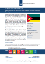
This one-pager provides details on the LAND-at-scale project in Mozambique. This project is implemented by Centro Terra Viva and Terra Firma, and financed by the Ministry of Foreign Affairs via the Netherlands Enterprise & Development Agency.

LAND-at-scale is a land governance support program for developing countries from the Ministry of Foreign Affairs of the Netherlands, which was launched in 2019.

The forest landscapes of the Greater Mekong Subregion (GMS) are changing dramatically, with a multitude of impacts from local to global levels. These changes invariably have their foundations in forest governance.
Economic globalization promotes the economic development of underdeveloped regions but also influences the ecological environments of these regions, such as natural forest degradation.
ABSTRACTED FROM CONTEXT SECTION: A study was commissioned by the Mekong Region Land Governance Project (MRLG) to investigate the origins and the implications of implementing the 70 percent forestland policy, and to outline policy considerations.
In 2010, the Vietnamese government implemented a national payment for ecosystem services (PES) policy. In promoting the policy, the government has conveyed PES as a successful policy that has achieved multiple objectives, including forest protection and poverty alleviation.
Armed conflicts create drastic socioeconomic shocks that lead to land use and land cover changes in ways that are not yet well understood. Several studies have used satellite imagery to detect such changes during periods of conflict.