Land Library
Welcome to the Land Portal Library. Explore our vast collection of open-access resources (over 74,000) including reports, journal articles, research papers, peer-reviewed publications, legal documents, videos and much more.
/ library resources
Showing items 1 through 9 of 15.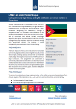
This one-pager provides details on the LAND-at-scale project in Mozambique. This project is implemented by Centro Terra Viva and Terra Firma, and financed by the Ministry of Foreign Affairs via the Netherlands Enterprise & Development Agency.

Although advances in remote sensing have enhanced mapping and monitoring of irrigated areas, producing accurate cropping information through satellite image classification remains elusive due to the complexity of landscapes, changes in reflectance of different land-covers, the remote sensing data
In this study, we compared pixel-based image analysis and object-based image analysis (OBIA) as methods of land cover classification of urban areas, using high resolution digital aerial photography.
The prospect of GIS technology to create and to use of soil maps is stated.
AW3Dsup(TM), the world's most precise global 3D map service, became the world's first five-meter-resolution 3D map covering all global land spaces in April 2016 by using Advanced Land Observing Satellite (ALOS).
Application of the satellite remote sensing techniques to wildlife research began from discernment of the individual animal and/or evaluation of animal behavior from the photography experiments.
In this study,land cover data were digitized on topographical maps(1954,1984 and 2001).Land cover data were analyzed using ArcGIS and Fragstats programs.
Population growth in cities along with migration from rural areas dramatically increases the Land Use and Land Cover (LULC) changes. This study was conducted in Çanakkale province consisting of central part and its vicinities where rapid population growth and development have been taken place.