Land Library
Bienvenue dans la bibliothèque du Land Portal. Explorez notre vaste collection de ressources en libre accès (plus de 74 000), comprenant des rapports, des articles scientifiques, des articles de recherche, des publications évaluées par des pairs, des documents juridiques, des vidéos et bien plus encore.
/ library resources
Showing items 1 through 9 of 102.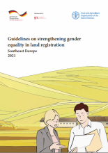
The present Guidelines form part of a joint effort by the Food and Agriculture Organization of the United Nations (FAO) and the Deutsche Gesellschaft für internationale Zusammenarbeit (GIZ) to help countries achieve indicator 5.a.2 of Target 5.a in the 2030 Agenda for Sustainable Development adop

Τα μεγάλα αστικά δέντρα αποτελούν φίλτρα για τους αστικούς ρύπους και τα λεπτά σωματίδια. Ένα δέντρο μπορεί να απορροφήσει έως και 150 κιλά CO 2 ετησίως, να δεσμεύσει τον άνθρακα και συνεπώς να αμβλύνει την κλιματική αλλαγή.
This Decree of the Ministry of Agriculture and Rural Development, which is composed of nine articles and five Annexes, lays down details on: (a) maintenance of the registration and information system and the database related to the management of agricultural land in vulnerable areas; (b) obtainin
This Decree of the Ministry of Agriculture and Rural Development, which is composed of 17 articles and eight Annexes, lays down details on: (a) the soil sampling procedure, the method and scope of the agrochemical soil testing and the identification of soil properties of the forest land; (b) stor

The paper is aimed on verification of application of local territorial system of ecological stability as landscape-ecological limits and regulations in process of projecting of land consolidation on the model cadastral areas in the district of Žilina.
This Act lays down some amendments and addenda to Fertilizers Act.
This Decree of the Ministry of Environment, which is composed of 14 articles and six Annexes, lays down requirements for the landfill of waste and temporary storage of metallic mercury.
This Law amends certain articles part of the Law on sanitary and health inspection (Official Gazette 87/2013, 106/2013 and 137/2013).Changes are related to the administrative and legal issues defining the entry onto force of specific provisions.
Currently the most common methods in forestry mapping includes digital photogrammetry, positioning points system using Global Navigation Satellite Systems (GNSS), or a combination of polar method using universal surveying stations.